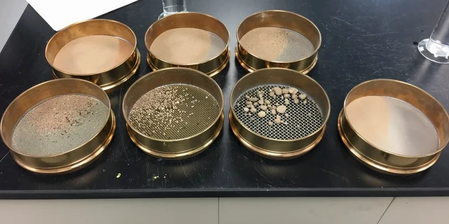
Brighton sits on a complex chalk escarpment that plunges beneath Quaternary deposits along the coastal plain, with ground elevations ranging from sea level to over 100 metres within the city limits. This geological transition creates highly variable particle size distributions across relatively short distances: coarse chalk gravels in the north, silty sands through the city centre, and marine clays near the marina. A grain size analysis combining sieve and hydrometer methods provides the full grading curve needed for classification under BS 5930:2015+A1:2020. The chalk geology that defines the South Downs means even small variations in fines content can shift a material from free-draining to frost-susceptible, which matters enormously for pavement design and foundation drainage. When site investigation boreholes encounter mixed strata, we often pair the particle size distribution with Atterberg limits to confirm plasticity characteristics, and run CPT testing where continuous profiling through the chalk-sand interface is required.
Putty chalk fines in Brighton can shift a soil from granular to cohesive classification with just a 5% increase in silt content — the hydrometer curve catches what sieves miss.